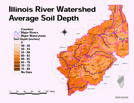
Thematic Maps can portray anything economic to geographic features of a particular area. These maps usually portray one theme and use contrasts in color or boundaries to show the differences. This particular map shows the soil depths in Illinois and uses different shades of a particular color to show the contrasts.

http://ilrdss.isws.illinois.edu/maps/maps_thematic/soildepth.gif
No comments:
Post a Comment